
Today a new version of the Water Map of Finland was published.
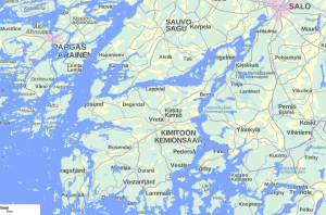
One can see a particular water, or over a larger area. Like the island of Kemiö:
If you choose to see the ecological status of the waters, you get this:
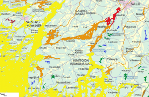
Yellow means ”moderate” status. The Archipelago Sea is not feeling well. And that we all know, who live near by.
Only 5 lakes have any kind of ecological status on the island of Kemiö. Maybe when the next Ecological-program of the municipality will get running, we will get the rest of the lakes evaluated as well.
Lake Dragsfjärden has also status moderate, which surprises me.
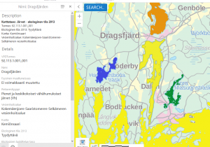
Yes, there has been some problems with blue-green algae, but on the whole it is a very nice, clean lake. Maybe a couple of more samples would change the status?